

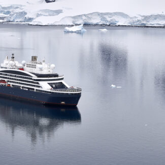
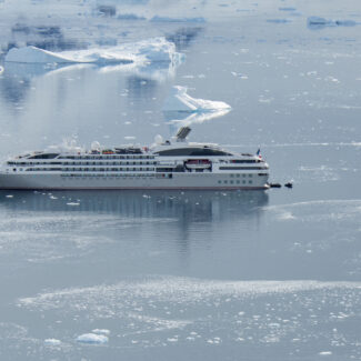
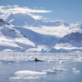


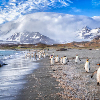
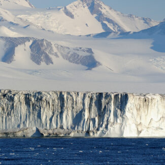
¿A quién pertenece la Antártida? Territorios antárticos y reivindicaciones nacionales

- Territorial Claims on the White Continent: What Countries Claim Antarctica?
- Map of Antarctica Territories
- List of Antarctic Territorial Claims
- Adélie Land (France)
- British Antarctic Territory (U.K.)
- Ross Dependency (New Zealand)
- Peter I Island (Norway)
- Queen Maud Land
- Australian Antarctic Territory
- Chilean Antarctic Territory
- Argentine Antarctica
- Past Antarctic Territorial Claims & Unrecognized Claims
- Other Countries ‘In’ Antarctica
Who owns Antarctica? Well, nobody, technically. This fifth-biggest continent is managed through the system of international cooperation established in 1959 by the innovative Antarctic Treaty. This system reserves Antarctica—a condominium over which no one political entity has sovereignty—for peaceful scientific purposes.
But a number of countries had made territorial claims on Antarctica during the first half of the 20th century. The Antarctic Territory acknowledged those existing claims while forbidding their expansion as well as the creation of any new ones. For all intents and purposes, Antarctica’s territorial claims are not internationally recognized (aside from the agreement, more or less, between the countries that made them) or considered binding.
Territorial Claims on the White Continent: What Countries Claim Antarctica?
Seven different countries made eight territorial claims in Antarctica ahead of the adoption of the Antarctic Treaty: the U.K., Argentina, Chile, France, Norway, Australia, and New Zealand. Almost all of these land claims are sectors of pie-slice shape stretching north to south between the Antarctic Circle and the South Pole, and together they account for more than 80 percent of the White Continent. Most of Marie Byrd Land in West Antarctica falls outside these sectors, making it the largest unclaimed part of Antarctica (and, indeed, of the globe).
Some Antarctic explorations beginning in the 1840s began declaring Antarctic land for the nations whose flags they flew. Britain was the first to formalize a land claim in 1908, with the other countries making their declarations between 1923 and 1940.
The impetus to establish Antarctic territorial claims sprang from multiple impulses, including interest in the frozen continent’s natural resources and jostling for geopolitical advantage. And the justifications for making land claims are varied and complicated. Among other grounds, they include (relative) geographic proximity to the Antarctic zone; history of exploration at the bottom of the world; and, in the case of Chile’s and Argentina’s reference to 15th-century geographic declarations of the Spanish Empire, historical documents long predating the discovery of Antarctica.
All seven of the claimant countries were among the original dozen signatories of the Antarctic Treaty, along with Belgium, Japan, South Africa, the U.S., and the U.S.S.R.
Just what these territorial claims mean today isn’t exactly clear-cut. As we’ve mentioned, they aren’t widely recognized, but none of the seven claimants have shown signs of renouncing them. And two signatories of the Antarctic Treaty without territorial claims, the United States and Russia, reserved the right to make such claims in the future, despite the Treaty’s ban otherwise on new declarations.
The Treaty’s prohibition on mineral development in Antarctica is up for debate beginning in 2048; this and other potential future modifications of the Treaty hint at the possibility that these highly ambiguous claims could be more forcefully asserted down the line.
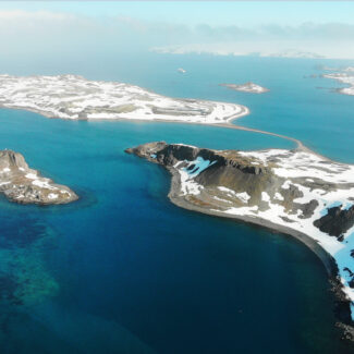
Map of Antarctica Territories
[INSERT]
List of Antarctic Territorial Claims
Let’s take an icy tour of these questionable territorial claims on Antarctica, shall we? France, the U.K., Chile, Argentina, Australia, and New Zealand have one claim each, while Norway maintains two.
Adélie Land (France)
This roughly 167,000-square-mile sector of East Antarctica has been claimed by France since 1840, when the explorer Jules-Sébastien-César Dumont d’Urville discovered the region and named it for his wife Adélie.
Set roughly between 136 degrees E and 142 degrees E, Terre Adélie comes edged by Wilkes Land and George V Land, both part of the Australian Antarctic Territory, and runs from a 220-mile coastline southward to the South Pole. It’s one of the components of the French Southern & Antarctic Territories, along with the Kerguelen, Crozet, and several other Indian Ocean island groups.
Adélie Land is dominated by the high frozen plateau of the East Antarctic Ice Sheet; fierce katabatic winds draining off the ice plateau wrack the Adélie Coast. Off that coast, near France’s Dumont d’Urville Station (established 1956), lies the South Magnetic Pole, situated more than 1,500 miles from the Geographic South Pole.
British Antarctic Territory (U.K.)
The British Antarctic Territory covers more than two million square miles, though only about 660,000 square miles of this is tierra firme. Largest of the 14 British Overseas Territories, it comes bounded longitudinally by 20 degrees W and 80 degrees W.
This vastness includes the Antarctic archipelagos of the South Orkney and South Shetland islands, the Antarctic Peninsula, most of the Ronne-Filchner Ice Shelf, and parts of the Transantarctic Mountains, and covers portions of Graham Land, Palmer Land, Coats Land, Ellsworth Land, and Queen Elizabeth Land, the latter declared in 2012.
The British Antarctic Territory was created in 1962 from much of a previously designated territory known as the Falkland Islands Dependencies, which dates back to the first decade of the 20th century. The territory overlaps with the land claims of both Argentina and Chile; that overlap has been the cause of some friction in the past.
Ross Dependency (New Zealand)
The Ross Dependency, one of the smallest of the Antarctic territorial claims, was initially declared for Britain in 1841, by Sir James Clark Ross. Since 1923, it’s been overseen by New Zealand. Set between 160 degrees E and 150 degrees W, and running from 60 degrees S to the South Pole, the Ross Dependency is dominated by the Ross Ice Shelf, the Ross Sea, and the Southern Ocean, and includes part of Victoria Land and a smidgen of Marie Byrd Land.
A number of research stations run by several different countries fall within the Ross Dependency. These include New Zealand’s own Scott Base as well Italy’s Zucchelli Station, South Korea’s Jang Bogo Station, and the U.S. McMurdo Station as well as part of the U.S. Amundsen-Scott South Pole Station. China is constructing a research base of its own in the Ross Dependency (on Inexpressible Island in Terra Nova Bay).
Peter I Island (Norway)
One of two territorial claims by Norway in Antarctica, Peter I Island is unique in that it’s the sole Antarctic claim that’s not a sector in shape. This roughly 60-square-mile volcanic island, almost completely ice-capped, lies in the Bellingshausen Sea off the coast of Ellsworth Land in West Antarctica.
Although Norway claimed the island in 1931, it was named more than a hundred years before by the Russian captain Fabian Gottlieb von Bellingshausen to honor Tsar Peter the Great. Bellingshausen’s sighting of the island in October 1921 marked the first land recorded south of the Antarctic Circle.
Queen Maud Land
Queen Maud Land (Dronning Maud Land) is the massively bigger other Norwegian territorial claim in Antarctica, covering about a million square miles of the East Antarctic Ice Sheet and a mostly ice-walled seacoast. Norway first charted this area in 1930, naming it for the Norwegian queen Maud of Wales, and formally claimed it nine years later.
Stretching between 20 degrees W and 4 degrees E, Queen Maud Land borders the British and Australian Antarctic territories, and its oceanfront comprises the Princess Martha, Princess Astrid, Princess Ragnhild, Prince Harold, and Prince Olav coasts. (A whole lot of royalty woven into the nomenclature in this zone.) The 1939 claim didn’t actually specify the southern boundary of the claim, which Norway only declared as extending to the South Pole, like the other sectors, in 2015.
Queen Maud Land includes some of Antarctica’s most striking scenery, particularly where numerous lofty mountain ranges pierce through the thick ice sheet as blocky and toothy peaks and nunataks, some exceeding 10,000 feet high. The claim includes more than a dozen research stations, including Norway’s own Troll and Tor facilities.
Australian Antarctic Territory
The largest territorial claim of all in Antarctica is that made by Australia. The Australian Antarctic Territory covers about 2.3 million square miles in East Antarctica, a swath accounting for approximately 42% of the White Continent. The Australian Antarctic Territory lies between 45 degrees E and 160 degrees E, excluding the narrow wedge of France’s Adélie Land that splits the Australian claim.
Nine units subdivide the Territory: Oates Land, George V Land, Wilkes Land, Queen Mary Land, Kaiser Wilhelm II Land, Princess Elizabeth Land, Mac. Robertson Land, Kemp Land, and Enderby Land.
This huge area includes land originally claimed by the British beginning in the mid-19th century and transferred to Australia in 1933. It’s classed with a slew of Sub-Antarctic, Indian Ocean, and South Pacific islands as part of the Australian External Territories. Numerous research bases fall within the Australian Antarctic Territory, including Australia’s year-round Mawson, Davis, and Casey stations as well as, among other countries’ operations, the well-known Vostok Station of Russia.
The Australian Antarctic Territory includes the loftiest ice dome of the East Antarctic Ice Sheet: 13,428-foot Dome A, apex of the Antarctic Polar Plateau and a strong contender for the coldest place on Earth.
Chilean Antarctic Territory
Chile’s Antarctic territorial claim encompasses some 483,000 square miles on the Antarctic Peninsula as well as adjoining parts of the West Antarctic interior (including the highest peaks of the White Continent, in the Sentinel Range of the Ellsworth Mountains) and such islands as the South Shetlands and Alexander Island.
Covering 53 degrees W to 90 degrees W, this pie wedge (which composes the Chilean commune of Antárctica) overlaps those of Argentine Antarctica and the British Antarctic Territory. As with Argentina, Chile’s arguments for its geographic authority in Antarctica extend back centuries to the Spanish colonization of South America, though its claim wasn’t formalized until 1940.
The Chilean Antarctic Territory includes a number of research bases and stations, both year-round and seasonal. The largest is Base Presidente Eduardo Frei Montalva on King George Island.
Argentine Antarctica
Argentina’s territorial claim in Antarctica, formalized in 1940, spans 25 degrees W to 74 degrees W. Covering some 564,000 square miles, it includes the Antarctic Peninsula, most of the Ronne-FIlchner Ice Shelf, and parts of the Transantarctic Mountains, among other geographies, and overlaps with the claims of both Chile and the U.K. (Argentina and Britain engaged in the most serious territorial conflict in Antarctica proper back in 1952, when warning shots were fired in dispute of the ownership of Hope Bay on the Antarctic Peninsula.)
Argentine Antarctica includes a number of scientific bases, including the first permanently established on the White Continent: Orcadas, erected in the South Orkneys in 1904.
Past Antarctic Territorial Claims & Unrecognized Claims
Historical land claims in Antarctica include Nazi Germany’s 1939 declaration of “New Swabia,” a coastal portion of Queen Maud Land over which German planes dropped metal swastikas.
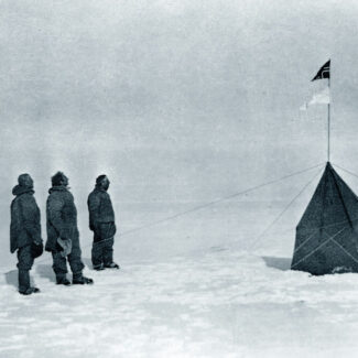
And it’s worth noting that some Antarctic explorers made land claims that were never even recognized by the sponsoring nations. Those include, for example, Roald Amundsen’s claim of the Antarctic Polar Plateau encircling the South Pole for Norway in 1911; the declaration of the “Yamato Yokihara” region for Japan by the head of the 1910-1912 Japanese Antarctic Expedition, Shirase Nobu; and Richard Byrd’s claims of parts of the Ford Ranges in Marie Byrd Land for the U.S. in 1929.
Other Countries ‘In’ Antarctica
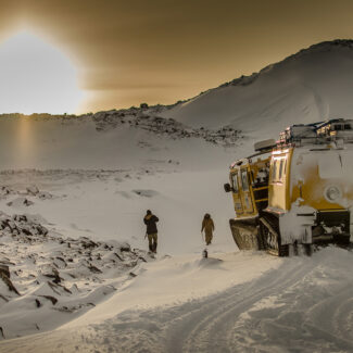
Keep in mind that many other countries besides those making Antarctic territorial claims have an important presence on the White Continent. Most notably, more than 40 countries have research stations in Antarctica, from the U.S. to South Korea. Unsurprisingly, most of these research stations fall within one or another of the historic territorial claims.
If you’re keen for more insight into Antarctica’s geopolitical angle, check out our posts on the Antarctic Treaty y el flags of Antarctica.

¿Dónde está el Polo Sur? En la Antártida. Pero hay 7.
Aurora Australis: Las auroras australes
Día y noche, horas de luz y sol de medianoche en la Antártida
El amanecer, el atardecer y el fenómeno del destello verde en la Antártida
¿Un agujero gigante en la Antártida? Eso será una polinia
Cordilleras y montañas de la Antártida
La capa de hielo de la Antártida, sus plataformas de hielo y el impacto del deshielo
Los glaciares de la Antártida: Thwaites 'Doomsday', Beardmore y más
Antártida sin hielo: ¿hay tierra bajo la Antártida?
Descargo de responsabilidad
Nuestras guías de viaje tienen únicamente fines informativos. Si bien nuestro objetivo es proporcionar información precisa y actualizada, Antarctica Cruises no hace ninguna representación en cuanto a la exactitud o integridad de cualquier información en nuestras guías o encontrado siguiendo cualquier enlace en este sitio.
Antarctica Cruises no puede y no aceptará responsabilidad por cualquier omisión o inexactitud, o por cualquier consecuencia derivada de ello, incluyendo cualquier pérdida, lesión o daño resultante de la visualización o uso de esta información.