Antarctica Iceberg Guide: An A23a - Z
The Antarctic is the world’s greatest iceberg playground, bar none. After all, Antarctica lays claim to some 90 percent of all the ice on Earth, so it should come as no surprise that the White Continent and the surrounding Southern Ocean contain the majority of the world’s icebergs by far.
These mesmerizingly-beautiful isles of floating ice are not only most numerous here at the bottom of the world but also reach their largest size, and rank among the most coveted scenic highlights for many travelers to the White Continent.
They’re a defining part of the Antarctic realm, needless to say, and plenty of research is devoted to parsing out just how they form, move, and affect the environment.
What is an Iceberg?
The word iceberg comes from Dutch, roughly translating to “ice mountain.” It describes a chunk—or, rather, hunk—of freshwater ice that’s larger than 15 meters (49 feet) long and 10 meters (33 feet) wide, and which protrudes at least five meters (16 feet) above the waterline. Smaller bodies of floating glacial ice rising between one to five meters (3 – 16 feet) above sea level aren’t icebergs but bergy bits, with anything smaller still known as growlers.
Beyond their minimum size threshold, icebergs come in a huge range of sizes, with giant icebergs sometimes classified as those exceeding 6.2 miles (10 kilometers) along at least one axis.
How are Icebergs Formed?
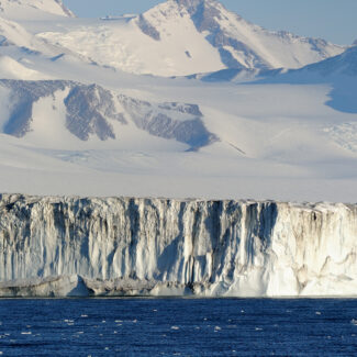
Icebergs are born when sections of ice shelves—the floating seaward extensions of inland ice sheets and glaciers—or tidewater glaciers break off into the ocean, a process called calving. While the bergs themselves usually only survive on the order of years, the glacial ice that makes them up can be thousands of years old.
Because ice is less dense than saltwater, bergs float—rather infamously, with only about 10% of their mass, their freeboard extent, above the water. Both wind and ocean currents help dictate the movement of icebergs, but because most of their mass is underwater, currents are the most significant driver—especially for larger icebergs, not least giant bergs, which unsurprisingly aren’t so beholden to the whims of wind. Icebergs also get seasonally locked in Antarctic sea ice and then move with the frozen pack.
How do Icebergs Decay?
Icebergs decay through a variety of mechanisms, including basal melting on their undersides and erosion along their sides by ocean waves. That wave erosion tends to be the most significant destructive force overall, but it has less of an impact—with basal melting having a proportionately greater effect—when it comes to giant icebergs. Tabular bergs (defined in a moment) that drift north from Antarctic into warmer latitudes often develop meltwater ponds on their surface, the drainage of which can open fissures within the ice.
Types of Icebergs
Icebergs are broadly classified into two categories based on their shape: tabular, which are broad, tabletop-shaped bergs, and non-tabular, which includes icebergs of all other shapes. Tabular bergs are the largest icebergs, and there’s no greater “factory” for them than Antarctica’s ice shelves.
Non-tabular icebergs, meanwhile, can be further subdivided based on their profile into such categories as domed, drydock, pinnacled, and blocky bergs.
Iceberg Colors
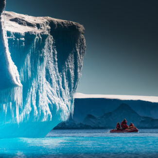
Think all icebergs are white? Think again! As we’ve written about elsewhere, icebergs can come in multiple shades and color patterns, ranging from blue bergs (where more pure glacial ice is exposed) to the striped bergs that often result when seawater infiltrates and then freezes within cracks in the ice.
Effects of Antarctic Icebergs
Antarctic icebergs have all sorts of varied impacts. They can block the movement of thinner sea ice, which then thickens on the windward side of the obstruction and leads to ecologically and oceanographically significant areas of open water—polynyas—on the leeward side. Bergs trapped in sea ice can hasten its movement, on account their tall freeboard profiles can serve essentially as sails.
And the melting of bergs releases large quantities of freshwater as well as “dust nutrients” from glacial sediments into the ocean, promoting phytoplankton growth, affecting ocean density, and creating upwellings, among other effects.
The calving of large icebergs may also influence the rate of ice flow into an ice shelf. Ice shelves have been shown to slow the seaward release of ice from ice sheets and glaciers, so scientists pay close attention to anything that affects that flow rate—including diminishment of the size of the ice shelf itself. While iceberg-calving is a normal, ancient characteristic of ice shelves, there’s concern that a warming climate might increase the rate of calving as ice shelves decay, which could speed up glacial outflow into the ocean and thereby raise sea levels.
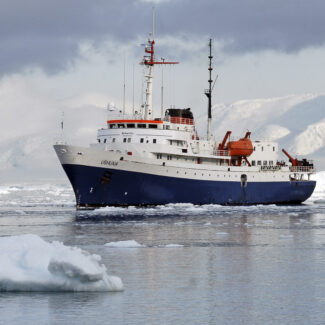
Of course, icebergs the world over are known as shipping hazards: There’s probably no more famous (infamous) block of frozen water than the Arctic berg which took down the Titanic in the North Atlantic. Southern Ocean icebergs are thought to have accounted for at least some of the many shipwrecks off Cape Horn and its associated shipping routes. Thankfully, modern navigational equipment makes the risk of an iceberg-collision vanishingly low on an Antarctic voyage; the one modern example, the 2007 sinking of the MV Explorer (which resulted in no casualties), was attributed to a rare case of human error.
Distribution & Movements of Icebergs in Antarctica & the Southern Ocean
A 2017 paper published in the Annals of Glaciology produced some interesting stats about Antarctic icebergs. The authors estimated some 132,269 bergs were then found in the Southern Ocean, collectively covering some 21,546 square miles (55,806 square kilometers) and representing perhaps 4,053 cubic miles (16,893 cubic kilometers) of ice.
Analyzing the typical geographic distribution of Southern Ocean icebergs, the Annals of Glaciology paper noted the greatest concentrations of bergs were usually found in and north of the Weddell Sea, between about 0 degrees and 60 degrees W latitude; off the East Antarctic coastline near the Amery, West, and Shackleton ice shelves, between about 60 degrees E and 120 degrees E; and in the Ross and Amundsen seas between about 120 degrees W and 160 degrees W.
This analysis suggested that three summertime cyclonic (low-pressure) systems in the Southern Ocean centered at about 120 degrees W, 30 degrees E, and 110 degrees E help drive significant iceberg movements: shunting bergs north into the open ocean along their western peripheries and, conversely, pushing them south on their eastern peripheries.
Northward-cruising icebergs from Antarctica often get entrained in the mighty east-flowing Antarctic Circumpolar Current (aka the West Wind Drift), the defining oceanic “river” of the Southern Ocean and the world’s biggest and strongest current.
As a different paper from 2017, this one published in JGR Oceans, found, smaller Antarctic icebergs commonly drift toward the open ocean, while giant bergs tend to circulate in coastal waters except for specific areas—in the Weddell and Ross seas as well as close to the mostly submerged Kerguelen Plateau—where they can escape coastal currents and head offshore.
One iceberg tagged for scientific tracking in 1999 actually completely circumnavigated the White Continent.
Northern Boundary of the Southern Ocean Iceberg Zone
As that aforementioned Annals of Glaciology paper explains, the main northern boundary of the Southern Ocean iceberg zone is the Antarctic Convergence or Polar Front, where north-flowing Antarctic waters meet south-flowing temperate waters.
Along much of its reach, this oceanic convergence corrals most Antarctic bergs from drifting northward, and the significantly warmer waters north of it also limit the longevity of any bergs that do start journeying into lower latitudes.
That said, there are a few spots where the main iceberg-zone boundary doesn’t correspond so well with the Polar Front. The iceberg zone is, for example, usually well south of the Polar Front between 50 degrees E and 80 degrees E, probably because there’s not a significant source of coastal icebergs to the near north and because Weddell Sea-sourced bergs drifting eastward toward this area in the West Wind Drift typically melt off before they get there.
Between o degrees and 30 degrees E, meanwhile, the northern boundary of the iceberg zone extends past the Polar Front to between 44 degrees and 46 degrees S, perhaps because of the eddies generated where the West Wind Drift edges against the Agulhas Current of the southwestern Indian Ocean.
Icebergs also often drift north of the Polar Front between 100 degrees E and 120 degrees E, where a powerful north-flowing current can capture bergs, a few of which may even approach New Zealand. (That happened, for instance, in 2006, when several icebergs ultimately deriving from a calving event from Antarctica’s Ronne Ice Shelf in 2000 showed up off the South Island’s Otago coast.)
It’s not uncommon for Southern Ocean icebergs to drift into the Drake Passage, which separates Antarctica from South America, and to lumber into the waters around South Georgia. As we’ll touch upon later, more than a few tabular bergs have threatened that mountainous, sealife-rich island, which the BBC has described as “something of a graveyard for Antarctica’s greatest icebergs.”
We ought to note that research suggests Antarctic icebergs during prehistoric times, namely the glacial periods of the Pleistocene, traveled much farther north on a regular basis than they do today—a consequence of Southern Ocean sea ice extending into lower latitudes then, and calmer ocean currents. Bergs might’ve sailed nearly to the southern coast of Africa in those periods, and the huge amounts of freshwater they unleashed in the Atlantic likely significantly impacted oceanic circulation.
Naming Icebergs
A multi-agency outfit of the United States, the U.S. National Ice Center (USNIC), tracks all Antarctic icebergs 20 square nautical miles or larger. These monitored icebergs are given names based on the quadrant of Antarctica in which they were first sighted. The quadrants are defined, counterclockwise, as:
- A: 0-90 degrees W (Bellingshausen/Weddell Sea)
- B: 90 degrees W-180 degrees (Amundsen/Eastern Ross Sea)
- C: 180 degrees to 90 degrees E (Western Ross Sea/Wilkesland)
- D: 90 degrees E to 0 degrees (Amery/Eastern Weddell Sea)
So a particular iceberg’s name starts with the letter of the quadrant wherein it was initially observed, followed by a number that puts it in the sequence of tracked icebergs from that quadrant. An iceberg labeled A-17, therefore, is the 17th iceberg out of Quadrant A tracked by the USNIC.
When tracked icebergs break apart, sequential letter suffixes are used to name the resulting pieces. If that A-17 iceberg broke in two, for example, the segments would be named A-17A and A-17B.
Famous Antarctic Icebergs
The following are profiles of just some particularly significant Antarctica icebergs, including the biggest-documented examples.
Iceberg A-68
When A-68 calved off the Larsen Ice Shelf in July 2017—reducing that ice shelf’s area by 12 percent—it ranked as the largest iceberg in the world, some 109 miles (175 kilometers) long and 31 miles (50 kilometers) wide (about the size of the U.S. state of Delaware) and weighed better than a trillion tons. This was a very well-documented giant iceberg, the crack that produced it first being noted in 2010 and accelerating starting in 2016.
Initially drifting in the western Weddell Sea off the Antarctic Peninsula, Iceberg A68 broke off a piece within the first year or two of its life, the “mother berg” being then renamed A-68A. Ultimately escaping coastal waters and drifting northward, A-68A—still a monstrously large iceberg—seemed to be on a collision course with South Georgia by late 2020.
Researchers began fretting about the potential disruption to South Georgia’s currents and marine ecosystem—not least its globally significant breeding stocks of pinnipeds, penguins, and seabirds—should the mega-berg ground along the island.
As it happened, A-68A only edged South Georgia before breaking apart into smaller pieces. Though an ecologically disruptive grounding didn’t occur, scientists estimated that A-68A’s disintegration released on the order of 150 billion tons of freshwater into the ocean near South Georgia, potentially impacting phytoplankton and other elements of the ecosystem.
Iceberg A-23A
Currently, the world’s largest iceberg is A-23A, which also happens to be among the oldest on record: Its mother berg, A-23, calved off the Filchner-Ronne Ice Shelf in West Antarctica back in 1986, taking with it a Soviet research station, Druzhnaya. (Its equipment was salvaged during an airlift operation following the calving.)
That momentous calving event—produced by an ice-shelf crevasse known as the Grand Chasms, the enlargement of which had been tracked for decades—also yielded a couple of other giant bergs: A-22 and A-24, now-vanished siblings of A-23A.
A split in A-23 produced A-23A in 1991. The roughly 4,000-square-kilometer (1,500-square-mile) tabular berg, about twice the size of Greater London and three times as big as New York City, soon grounded in the Weddell Sea and remained stationary for more than three decades.
In 2020, satellite imagery showed A-23A pivoting, and soon thereafter the supersized berg was mobile once again and moving northward away from the White Continent. “Over time it’s probably just thinned slightly and got that little bit of extra buoyancy that’s allowed it to lift off the ocean floor and get pushed by ocean currents,” Oliver Marsh of the British Antarctic Survey told Reuters in November 2023.
In January 2024, a ship visited the then on-the-move A-23A—which an onboard videographer described to the BBC as “mind-bogglingly big”—and found wave action gnawing out spectacular ice arches and ice caves along its walls.
As of now though, Iceberg A-23A is going nowhere fast having become ‘stuck’—possibly for years to come—on top of a huge rotating cylinder of water, a phenomenon oceanographers call a Taylor Column. First described in the 1920s by physicist, Sir Geoffrey Ingram Taylor, when an ocean current meets an obstruction on the seafloor it can—under the right circumstances—separate into two distinct flows, generating a full-depth mass of rotating water between them. In A-23A’s case, that obstruction is a 100km-wide bump on the Southern Ocean floor known as Pirie Bank. The subsequent vortex has trapped A-23A in a spinning holding pattern just north of the South Orkney Islands, turning in an anti-clockwise direction by about 15 degrees a day.
There is some speculation it may ultimately follow a similar trajectory as certain other giant Weddell Sea icebergs and track toward South Georgia, roughly 650km (400 miles) north-east of its present position close to the South Orkney Islands, about 700km (430 miles) northeast of the tip of the Antarctic Peninsula.
Perhaps it will, as A-68A did, break apart before grounding against the island’s shallow shelf, but A-23A’s great size and notable thickness likely mean it will take awhile to disintegrate. At present, therefore, it remains a potential threat to those South Georgia seal and bird rookeries.
Iceberg A-76
Given its long lifespan, it’s not altogether surprising that Iceberg A-23A’s status as the world’s largest extant iceberg has been periodically yielded to other giant tabular bergs. That happened, for example, in May 2021, when mighty A-76 calved into the Weddell Sea off the Ronne Ice Shelf. It was a bit bigger than A-23A, measuring some 4,320 square kilometers (1,668 square miles).
But A-76 didn’t stay whole and enormous long, soon splintering into three pieces and thereby returning the world’s-largest-iceberg crown to A-23A.
Iceberg B-15
Another huge Antarctic iceberg that, for a time, stole A-23A’s mantle was B-15, which in fact was much bigger. Calved from the Ross Ice Shelf in March 2000, B-15 measured about 11,000 square kilometers (4,250 square miles) in area: a real ice colossus.
Indeed, B-15 is the largest scientifically documented iceberg known. A tabular berg sighted by the USS Glacier in the Southern Ocean west of Scott Island back in November 1956 was allegedly much bigger: The Glacier crew reckoned it some 335 kilometers (208 miles) long and 97 kilometers (60 miles wide), putting its total area past 31,000 square kilometers (12,000 square miles). But given this was before satellite photography, and all we’ve got is that onboard estimate, it’s hard to know for sure the exact size of that 1956 iceberg.
Meanwhile, that biggest reliably measured Antarctic iceberg, B-15, is no longer, having fractured into smaller and smaller bergs now nearly all melted off.
Iceberg A-38
The dangers giant icebergs pose to South Georgia’s ecosystem were demonstrated by Iceberg A-38, which calved from the Filchner-Ronne Ice Shelf in October 1998. Initially measuring 7,100 square kilometers (2,750 square miles) in area—making it another of the very largest icebergs on record—A-38 soon split into A-38A and A-38B.
Those hulking offspring ended up drifting to South Georgia, and the remnants of grounded A-38B interfered with the foraging routine of seals and penguins, with starvation-killed pups and chicks observed as an apparent result.
Viewing Icebergs in Antarctica
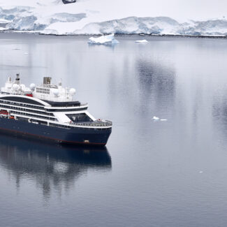
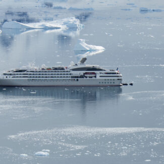
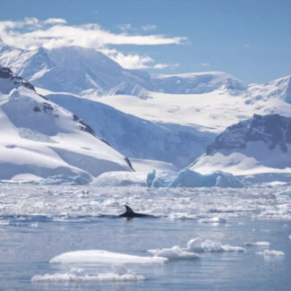
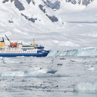
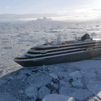
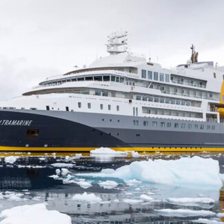
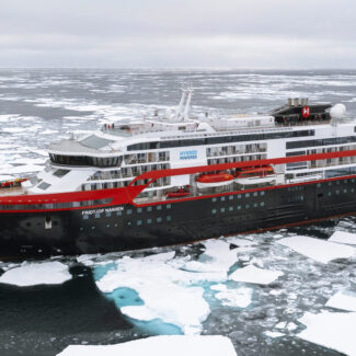
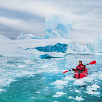
Icebergs make an unforgettable spectacle. While the truly monstrous giant tabular icebergs might dominate the record books, the much smaller bergs that cruisegoers more commonly encounter are just as amazing to witness, given their fabulous variety of form.
Lucky passengers crossing the Drake Passage often glimpse far-drifting icebergs—a sort of Antarctic welcoming committee—in that fabled waterway. More reliable and extensive viewing, though, awaits in the Weddell Sea and in places along the Antarctic Peninsula—especially the southern end of Lemaire Channel, where multitudes of these glazed sculptures give the waters around Pleneau Island the nickname of “Iceberg Alley” and Pleneau’s natural trap “Iceberg Graveyard.”
Disclaimer
Our travel guides are for informational purposes only. While we aim to provide accurate and up-to-date information, Antarctica Cruises makes no representations as to the accuracy or completeness of any information in our guides or found by following any link on this site.
Antarctica Cruises cannot and will not accept responsibility for any omissions or inaccuracies, or for any consequences arising therefrom, including any losses, injuries, or damages resulting from the display or use of this information.
