The Mountain Ranges & Mountains Of Antarctica
- Antarctic Mountain Ranges & Summits
- The Ellsworth Mountains
- The Transantarctic Mountains
- The Antarctic Peninsula Cordillera
- Other Mountain Ranges of East Antarctica
- Antarctica’s Ice-Buried Ranges
- The Volcanoes of Ross Island
- Mountains of Antarctic & Subantarctic Islands
- Seeing & Visiting Antarctica’s Mountains
Mountains in Antarctica? Peaks and pinnacles might not necessarily be the first landforms to come to mind when you think of the southern polar zone, but Antarctic mountains there are indeed, helping form the incomparable scenery of this incomparable icebound wilderness.
Antarctica, in fact, lays claim to some of the most extraordinary mountains on Earth, most of them rearing out of ice sheets, ice caps, and 0ther glacial complexes. Some stand high because of long-ago tectonic activity or thermal upbulging; some are volcanic in origin, built up by prehistoric subduction or active rifting and magmatic energy. And some aren’t even visible at the surface, buried deeply by the icy shroud that blankets most of the aptly nicknamed White Continent.
Antarctic Mountain Ranges & Summits
There are too many wonderfully remote ranges and isolated peaks in Antarctica to cover completely here, but what follows is a sweeping survey of some of the most notable mountain blocks and eminences at the bottom of the world.
The Ellsworth Mountains
Antarctica’s loftiest mountain range runs roughly north-south some 217 miles (350 kilometers) in West Antarctica, its east-side glaciers draining into the Ronne Ice Shelf of the Weddell Sea. The Ellsworth Mountains are named for the American explorer and pilot Lincoln Ellsworth, who first sighted them—”a very high, cloud-shrouded range”—during a 1935 flyover. Ellsworth called the mountains the Sentinel Range; that is now the label applied to the northern section of the Ellsworth Mountains, named in honor of Lincoln Ellsworth in the 1950s, when more of this mighty, ice-threaded range was mapped.
Boasting a rich stack of Paleozoic sedimentary and volcanic rocks and abundant with plant and invertebrate fossils, the Ellsworth Mountains constitute one of the major crustal blocks of West Antarctica. It’s thought that the Ellsworths were uplifted during the Jurassic, associated with the tectonic breakup of the great continent of Gondwana that once conjoined Antarctica with India, Africa, Madagascar, Australia, and South America.
The Minnesota Glacier, which flows east out of the mountain range into the Rutford Ice Stream, divides the Ellsworth Mountains into its two constituent sectors: the lofty, spectacular Sentinel Range to the north and the lower, more subdued Heritage Range in the south. Much of the western slope of the Sentinel Range is a steep-sided escarpment. The subrange’s highest peaks are the tallest in Antarctica, topped off by 16,050-foot (4,892-meter) Mount Vinson, apex of the Vinson Massif and its summit plateau.
As Antarctica’s highest point and one of the fabled Seven Summits—the loftiest mountaintops of each continent—Mount Vinson comes coveted by hardy climbers who are willing to journey to the deliciously remote setting and endure the harsh polar conditions. The first ascent came in 1966 by the American Antarctic Mountaineering Expedition led by Nicholas Clinch. (The Vinson Massif and its crowning peak, by the way, are named for a U.S. congressman, Representative Carl Vinson of Georgia, in recognition of his contribution to Antarctic exploration efforts.)
The other tallest peaks of the Sentinel Range of the northern Ellsworth Mountains include 15,919-foot (4,852-meter) Mount Tyree (second-highest mountain in Antarctica), 15,292-foot (4,660-meter) Mount Shinn, 15,003-foot (4,573-meter) Mount Gardner, and 14,795-foot (4,508-meter) Mount Epperly.
The partly ice-smothered ridges and horns of the Heritage Range lie below 8,202 feet (2,500 meters). Among this subrange’s defining features is the broad arena of the Horseshoe Glacier and Horseshoe Valley at its southern end, partly described by the southernmost, dribbling-out heights of the Heritage Range: the Marsh Hills, Independence Hills, Patriot Hills, and Enterprise Hills.
The Transantarctic Mountains
The mighty bedrock divide in Antarctica and arguably the White Continent’s single greatest mountain range, the Transantarctic Mountains tear up the polar skyline for some 2,175 miles (3,500 kilometers) between the Weddell and the Ross seas. Among the longest single mountain ranges in the world, they form the dramatic boundary between West and East Antarctica, separating the more youthful volcanic complex and rift system of the former from the higher, older, more stable bedrock landmass of the latter.
The Transantarctic Mountains reared up some 55 to 65 million years ago, as the Mesozoic rolled into the Cenozoic, and research suggests their high-standing stature is mainly owed to thermal buoyancy: upward pressure from mantle-heated rocks in this zone of regionally thin crust. That origin distinguishes this range from most of the other great mountain chains of the world, formed through tectonic compression or subduction. Indeed, the Transantarctics can be considered the “longest and tallest non-compression mountain range on Earth.”
And tall the Transantarctic Mountains are indeed, reaching 14,856 feet (4,528 meters) at the summit of Mount Kirkpatrick in the Queen Alexandra Range of the Ross Dependency. This is one of many defined subranges of the spectacularly long Transantarctics. Others include the Admiralty Mountains, the Concord Mountains, the Victory Mountains, the Commonwealth Range, the Horlick Mountains, and the Prince Albert Mountains, to name but a sample. Mount Elizabeth (14,700 feet/4,480 meters) in the Queen Alexandra Range is thought to be the highest unclimbed mountain in Antarctica.
Among the best-known and most arresting features of the Transantarctic Mountains are the McMurdo Dry Valleys, the largest oases—areas of snow/ice-free ground—in Antarctica. These cold-desert valleys owe their mostly bare landscape—host to intriguing saline lakes and the desiccated mummies of doomed, apparently disoriented seals—to the surrounding mountain ramparts, which cast them in a rainshadow and buffer them from outflow spillage of the East Antarctic Ice Sheet, and which also direct the strong, drying katabatic winds that rage downslope through the sere troughs.
The Antarctic Peninsula Cordillera
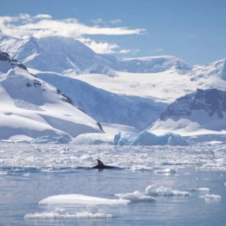
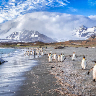
The northernmost, balmiest, and most-visited part of the White Continent is the long Antarctic Peninsula that extends from the West Antarctic subcontinent toward South America. The Peninsula also happens to be one of the most jaw-droppingly scenic parts of Antarctica—indeed, the world—in large part because of the close configuration of soaring, ice-swaddled mountain peaks and an iceberg-littered, wildlife-bustling seacoast.
The rugged mountains of the Antarctic Peninsula are, many geologists believe, remote extensions of the subduction-formed Andes that run down the entire western margin of South America: hence the alternative name for the Antarctic Peninsula Cordillera, the Antarcandes. (At least geographically speaking, this would also make the Antarctic Peninsula Cordillera the far southern extremity of the mighty American Cordillera that strikes the length of western North and South America—thus giving the peaks of the Antarctic Peninsula some distant kinship with the grizzly- and caribou-tromped Brooks Range of northern Alaska.)
The high point of the Antarctic Peninsula Cordillera was only determined in 2017, when scientists realized that Mount Hope in the Eternity Range, at 10,627 feet (3,239 meters), overtops the previously recognized pinnacle of 10,444-foot (4,184-meter) Mount Jackson, which rises above the Black Coast. (Mount Hope lies within the British Antarctic Territory, and thus is sometimes considered the loftiest mountain in lands claimed by the United Kingdom.)
Other Mountain Ranges of East Antarctica
Some of the most utterly spectacular peaks of Antarctica—many of them nunataks (rock summits rising out of completely encircling ice)—reside in the East Antarctic wilderness of Queen Maud Land/Dronning Maud Land. Here, spiky pinnacles, rock fangs, squaretop mountains, and other wild scenery help define such isolated ranges as the Filchner, Orvin, Drygalski, Mühlig-Hofmann, and Humboldt mountains.
Among the peaks fringing the huge Lambert Glacier draining into the Amery Ice Shelf, meanwhile, are the tall summits of the 260-mile-long (420-kilometer-long) Prince Charles Mountains, topped by 10,591-foot (3,228-meter) Mount Menzies.
Antarctica’s Ice-Buried Ranges
The impressively thick Antarctic Ice Sheet masks some remarkable landforms that would constitute rather awe-inspiring terrain were it exposed to Sun and Moon. For example, more than 100 subglacial volcanoes have been pegged to lie beneath the West Antarctic Ice Sheet.
And the Gamburtsev Mountains of East Antarctica thrust up peaks 9,186 feet (2,800 meters) or higher, but they’re completely hidden a few thousand feet below the surface of the East Antarctic Ice Sheet’s Polar Plateau.
The Volcanoes of Ross Island
Associated with the Terror Rift of the enormous West Antarctic Rift System, the volcanoes of Ross Island in McMurdo Sound have glowered over some of the great exploits of the Heroic Age of Antarctic Exploration. King of them all is the Earth’s southernmost active volcano, 12,448-foot (3,794-meter) Mount Erebus, in the Main Crater of which boils one of the planet’s few known lava lakes.
Other strato- and shield-volcanic hulks on Ross Island are Mount Terror (10,600 feet/3,230 meters), Mount Terra Nova (6,990 feet/2,130 meters), and Mount Bird (5,791 feet/1,765 meters).
Mountains of Antarctic & Subantarctic Islands
The farflung island groups of the Southern Ocean scattered about the Antarctic and Subantarctic realms host their own spectacular, glacier-cloaked mountain fastnesses, it’s worth noting.
The scenic Tangra Mountains, for instance, form the backbone of Livingston Island in the South Shetlands, reaching 5,600 feet (1,700 meters) at Mount Friesland. The biggest island in the South Orkneys, Coronation Island, rises to the summit of 4,153-foot (1,265-meter) Mount Nivea. A dead stratovolcano, Mont Ross, forms the 6,070-foot (1,850-meter) crown of the Kerguelen Islands, while South Georgia—the soaring, glaciated, then-uncharted spine of which Ernest Shackleton and his crewmates famously trekked across in 1916 on their improbable quest for rescue—reaches 9,629 feet (2,945 meters) atop Mount Paget.
Seeing & Visiting Antarctica’s Mountains
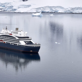
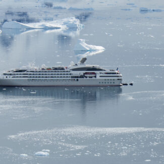
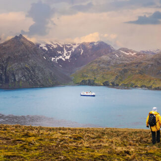
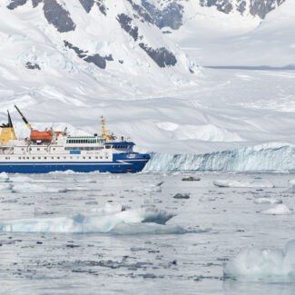
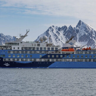
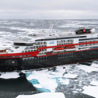
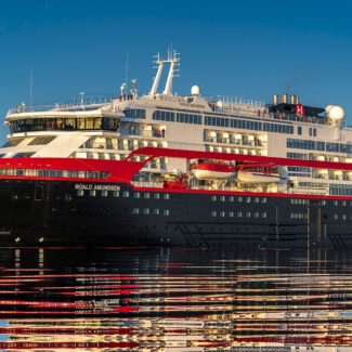
Any visit to Antarctica is likely to involve plenty of good old-fashioned mountain sightseeing. The most popular cruises embark for the peak-fortressed Antarctic Peninsula (sometimes hitting up mountainous Subantarctic and Antarctic islands along the way), giving travelers lots of unforgettable looks at the Antarctic Peninsula Cordillera.
And those wishing to spend some quality time in the Antarctic interior can find themselves basking in vistas to some of the most remote mountain formations on the planet, as from Wolf’s Fang Camp, where the scimitar peaks of the Kurze Mountains (a subrange of the Orvin Mountains) make a spectacular skyline, or the Vinson Base Camp, from which mountaineers strike off for the rooftop of Antarctica.
Disclaimer
Our travel guides are for informational purposes only. While we aim to provide accurate and up-to-date information, Antarctica Cruises makes no representations as to the accuracy or completeness of any information in our guides or found by following any link on this site.
Antarctica Cruises cannot and will not accept responsibility for any omissions or inaccuracies, or for any consequences arising therefrom, including any losses, injuries, or damages resulting from the display or use of this information.
